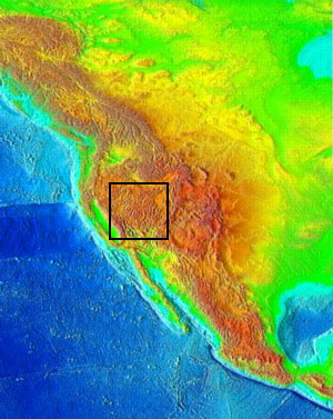
Despite a relatively high topography, the crust at the centre of the Basin and Range (western US) is only 22 km thick, and interestingly this region does not correspond to a plate boundary. Therefore, regions of high topography are not restricted to areas of thick continental crust. So, what's going on?
|
| Topography in the Basin and Range Province (black rectangle) in the North American Cordillera. Warm colours represent regions of high topography.
|
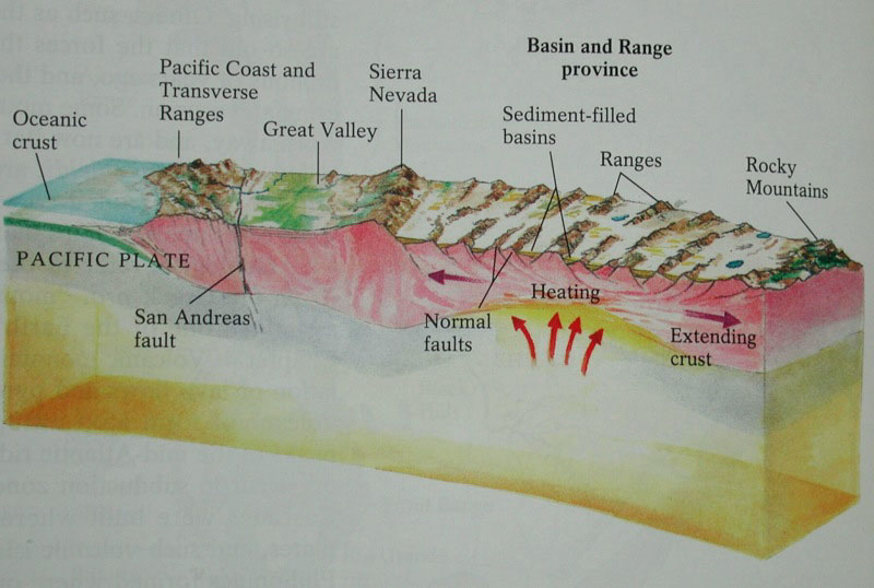
The block diagram below represents an E-W section through the Basin and Range province. A thermal anomaly underneath the continental crust has progressively turned the lithospheric mantle into asthenosphere (remember the base of the lithosphere is an isotherm). As this process proceeds, the average density of the lithosphere tends towards that of the crust. Isostasic adjustment explains the high topography of the region.
|
|
|