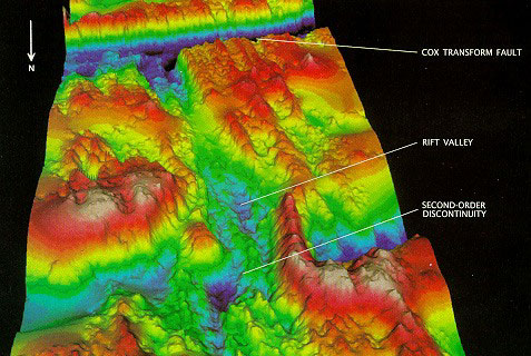
The Mid-Atlantic Ridge emerges as the South American and African plates pull apart at the "slow" rate of approximately 30 millimeters per year. The axis of the ridge is marked by a 2 km deep rift valley, which is typical of most slow-spreading ridges. The map reveals a 12 km jog of the rift valley, a second-order discontinuity, and also shows a first-order discontinuity called the Cox transform fault. Colours indicate depths from 1900 m (pink) to 4200 m (dark blue).
More at: http://magic.geol.ucsb.edu/~ken/sciam.html
|
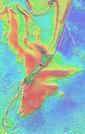
Computer-generated detailed topographic map of New Zealand and its surroundings, showing the extend of the Alpine transform fault. Some of the highest peaks on the southern hemisphere result from the Alpine fault.
|