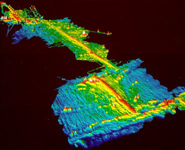
East Pacific Rise forms as the Pacific and Cocos plates separate at a "fast" rate of 120 millimeters per year. Here a map depicts a 1000 km stretch of the Rise, extending from 8-17°N. The map reveals two kinds of discontinuities: large offsets, about 100 km long, known as transform faults and smaller offsets, about 10 km long, called overlapping spreading centers (detail on the right). Colors indicate depths of from 2350 (pink) to 3500 meters (dark blue).
More at: http://magic.geol.ucsb.edu/~ken/sciam.html
|
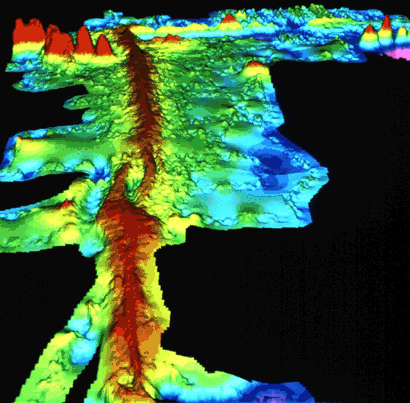
Computer-generated detailed topographic map of a segment of the Mid-Oceanic
Ridge of the East Pacific Rise. "Warm" colors (yellow to red) indicate
the ridge rising above the seafloor, and the "cool" colors (green to blue)
represent lower elevations. This image (at latitude 9° north) is of
a small part of the East Pacific Rise. The discontinuity in the middle
of the picture is called an overlapping spreading center. (Imagery of Stacey
Tighe, University of Rhode Island.)
More at http://pubs.usgs.gov/publications/text/topomap.html
|