 |
|||||||||||
| Notion of dynamics | 2/ | ||||||||||
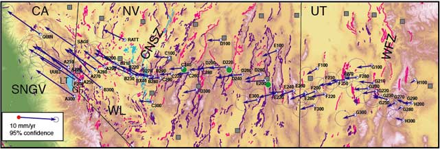
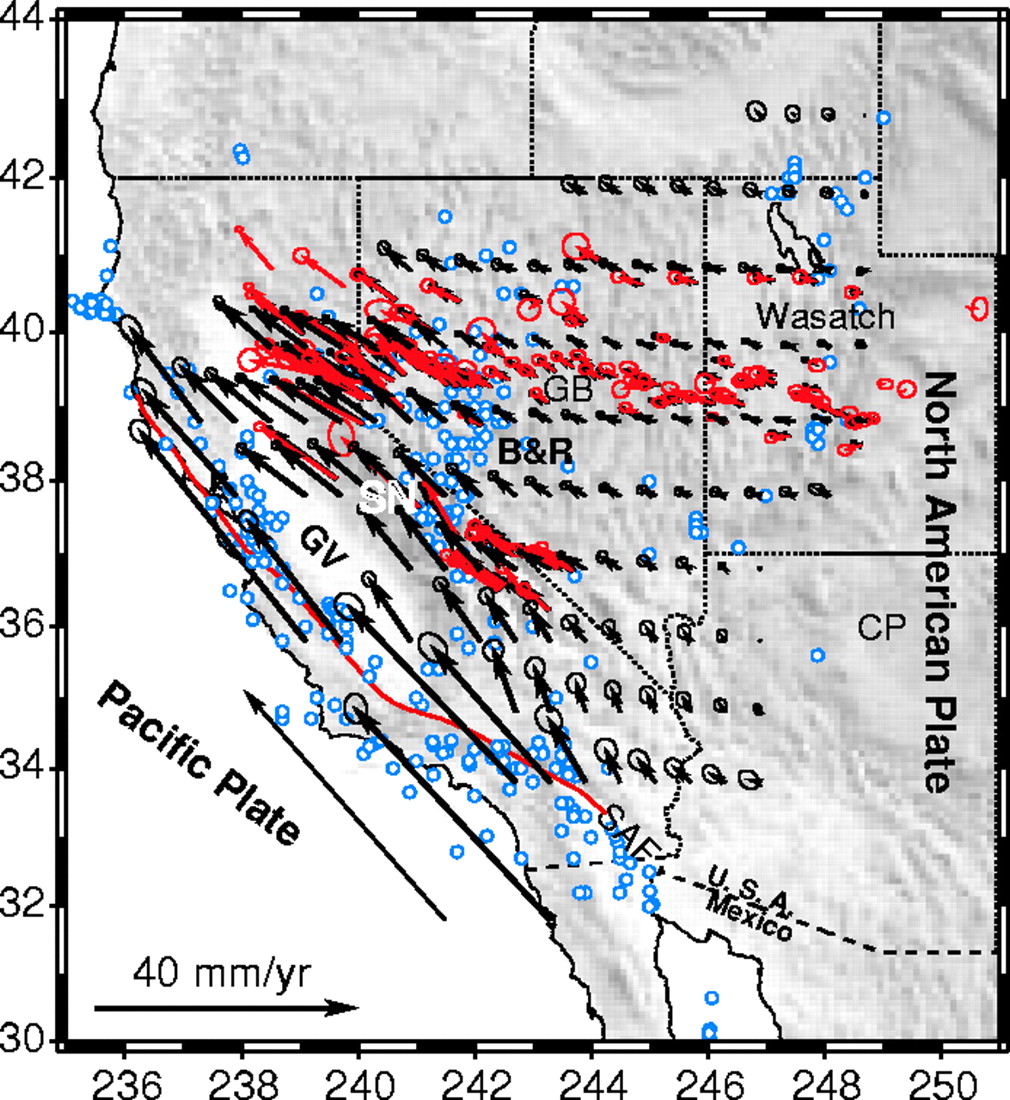
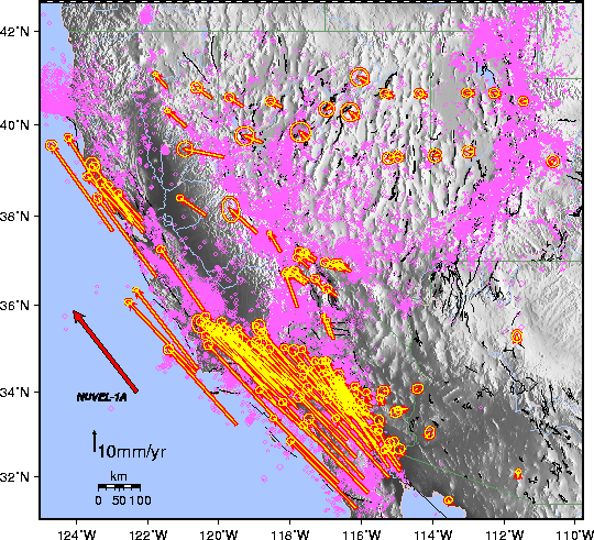
| Understanding crustal flow in the SW USA: Global Positionning System (GPS) and Very Long Baseline Interferometry (VLBI) are techniques used to measure displacement at the Earth surface. Pictures 1 to 3 show the velocity field in the SW USA. Bleu (1) and pink dots (3) represents earthquakes. Arrows: velocity vectors. 1/ Flesch et al., 2000. Science, 287. 2/ Hammond and Thatcher, 2004. J. Geophys. Res., 109. 3/ Bennett et al., 1999- Geology, 27, 371-374 | |||||||||||
 |
|||||||||||
 |
|||||||||||
| 1/ | |||||||||||
| 3/ | |||||||||||
|
|
|
|
|
|
|
|
|
|
|||