|
PRACTICAL 1: TOPOGRAPHIC CONTOURS, STRUCTURAL CONTOURS AND GEOLOGICAL MAPS. |
|
 |
 |
 |
|
|
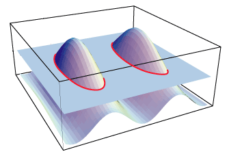
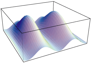
The trick is to replace the 3D surface by a bunch of topographic contours. Topographic contours joint, on the topographic surface, points that have the same elevation (i.e. iso-elevation lines). A topogaphic contour can be defined as the intersection between the topographic surface and an horizontal plane. |
|
|
|
Problem: How to represent in 2D, a 3D topographic surface keeping enough information to reconstruct the 3D picture ? |
|
|
|
 |
|
|
|
 |
|
|
|
 |
|
|
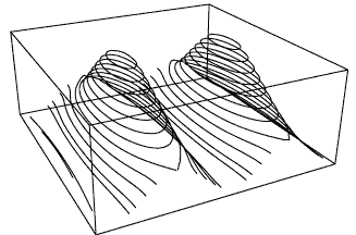
On the sketch on the right is a set of topographic contours. The difference in elevation between two successive topographic contours is constant. This image gives a good approximation of the 3D topographic surface, but it is still a 3D diagram. The orthogonal projection of these topographic lines onto a horizontal surface gives a topographic map, a simple 2D document easy to handle. |
|
|
|
|
|
|
|
|
|
|
|
|
|
|
|