Plate Boundaries Features: Seismicity
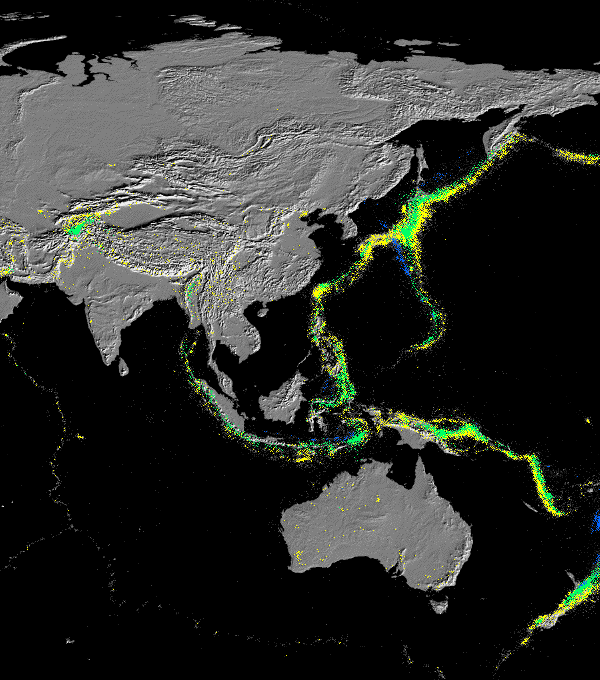
This picture shows the surface topography and distribution of earthquakes (coloured dots) in Asia. Yellow, green, and blue dots represent increasingly deeper earthquackes (Shallow earthquackes: 0-15 km deep; Deep earthquackes: over 300 km deep.)
There is a clear spatial relationship between areas showing large topography gradients and seismically active regions.
|
 |
|
 |
|