|
|
|
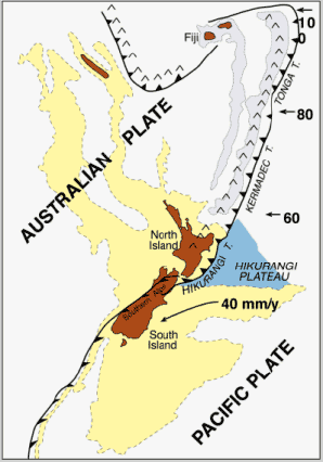
The Southern Alps is a good example of transform boundary |
|
|
|
 |
|
 |
|
|
| Setting of the New Zealand micro-continent (yellow-shading) stradling the obliquely convergent Australia-Pacific plate boundary zone. Numbered arrows show rates of relative convergence in mm/year. Inverted v represents active volcanic arcs. Dark blue represents anomalously thick oceanic crust of the subducting Hikurangy Plateau. |
|
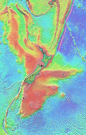
| This map respresents the topography of New-Zealand and its surroundings. In green to red is the continental crust most of it being under sea level. The linear anomalie running NE-SW is the boundary between the Indo-Australian plate and the Pacific plate. |
|
|
|
|
|
|
|
|
|