|
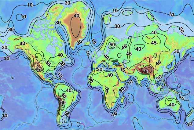
This map shows the superimposition of the topography of the world (warm colours => high topography) with isopach lines depicting the thickness of the continental crust. Regions with a thick continental crust such as Tibet and the South American Andes correspond to regions with elevated topography. There are however regions such as the South-West US that have elevated topography despite having a thin continental crust. This map tells us that: Crustal thickness gradient => High Topography
|